PLANETAI node · open source · runs on a computer you own
Observe here.
Decide here.
Act here.
A small program for the computer in your home, lab or community centre. It connects everything that measures where you stand, from the sensor on the wall to the satellite overhead, into one picture sharp enough to act on: the air, the heat, the sea, the land, today, here. Then it tells the people there what to do, and keeps count of whether they did.
An x86 Linux box first — a mini PC, or an old laptop you put Linux on. A Mac or Windows with WSL2 also work. Four questions. Alpha.
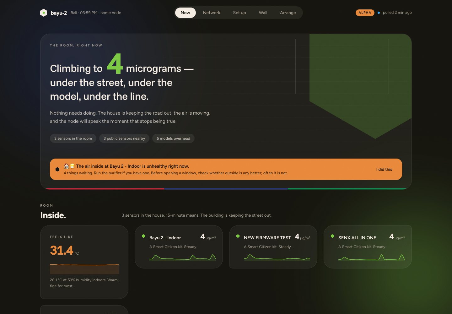
Every scale in one instrument
A particle sensor in the kitchen. A radio in a field with no WiFi. The public station down the road. The city’s open-data portal. The satellite and the atmosphere model overhead. One schema from your room to the planet, and the gap between them is the signal a map cannot see.
Awareness that becomes action
The node decides where it stands and tells the people there what to do, in plain sentences, on Telegram. Then it measures whether anything changed. Open the windows, move the clinic’s fridge, plant the shade. Community first, then city, then region.
Open source, made where it is used
Runs on hardware you already own. The data stays on it; summaries flow upward to the Fab City Index and to the models of a bioregion and a planet. Every domain is a pack anyone can write for their own place. Apache-2.0.
The kilometre around you
Your neighbourhood, drawn from the map and from orbit.
The node fetches everything OpenStreetMap knows within a kilometre and everything Google’s open satellite dataset sees, keeps the geometry in its own spatial database, and draws the place as an architect would: buildings in ink, roads as hairlines, green as green, every mapped use a dot. What only the satellite knows, in orange. No tiles, no account, works with the internet down.
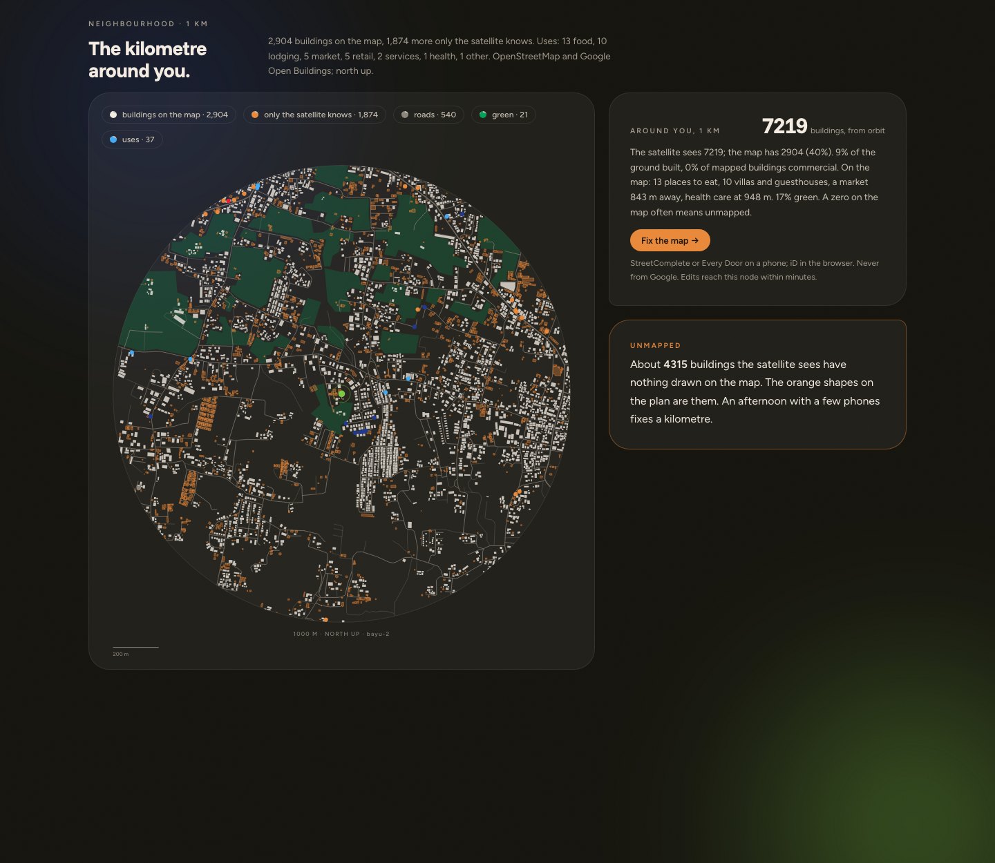
Buildings from orbit
Google Open Buildings, open data, read through Earth Engine with the same credentials the node uses for land cover. It finds what nobody has drawn.
On the map
The node counts the gap and writes the briefing for a mapping afternoon: which footprints have nothing near them, which buildings have no type, which places have no hours. Then a button opens the editor at your door.
Answers, not tiles
How many places to eat, the walk to the nearest clinic and market, how much of the ground is built and how much green. Stored beside your readings, queryable by any pack.
Act here
An observation that changes nothing is decoration.
Every alert says what is happening, what it means, and what to do. When you do it, you tell the node, in one line on Telegram or with a button on the dashboard. The node keeps one number for itself: how often what it said changed what someone did. That number, ρ, travels up to the Fab City Index. Nothing else ever measured it.
🔴 🔥🪟 Inside is worse than outside at SENX. Something in the house is making smoke or fine dust: cooking, incense, a candle, a mosquito coil. The air outside is cleaner than what you are breathing. 👉 Open a window or two and let it through.
/act 23 opened the kitchen windows
Recorded. Alert #23 led to an action. Thank you.
🏠 The kitchen is back under the street. Whatever it was, opening up worked.
Node #1 · running since 2 September 2026
One house in Kuta Selatan, Bali, seen from the kitchen to orbit.
Three sensors inside, one on the wall, the island’s public network, a radio gateway for the sensors with no WiFi, and overhead the Copernicus atmosphere model, the ocean model and Earth Engine’s view of the land. In its first week the node learned the street’s daily rhythm, how much of it the house keeps out, and that the satellite square knows the district but nothing about the kitchen. Two of every three alerts led to someone doing something, and the node keeps that number for itself.
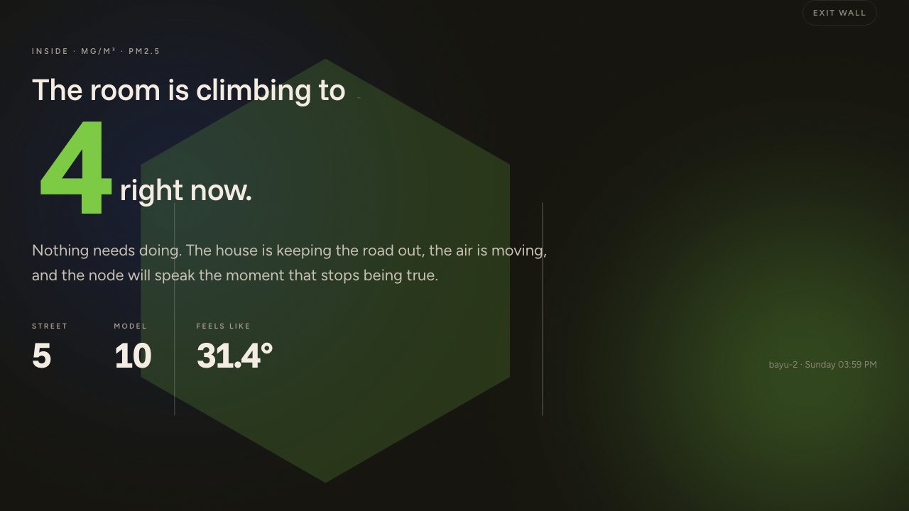
What a node does today
Alpha, and already a lot.
Reads every scale
Sensors on your WiFi, radios over LoRa where there is none, the public stations nearby, the city’s open data, atmosphere and ocean models, the land from satellites, the buildings from orbit and the map.
Speaks in sentences
Alerts that say what is happening, what it means for the people there, and what to do. In English or Bahasa Indonesia, on Telegram. Silent when nothing should change.
Answers questions
A bot on your Telegram runs on a small model on your own machine and uses a bigger one on your network or online when it can reach it. Ask how the air is, how big the swell is, what is around here.
Shows the place
A dashboard that reads from where you stand outward: room, street, the kilometre drawn, the region, and what you did. Arrange the cards; leave it on a wall screen.
Keeps count of you
ρ: the share of its alerts that led to someone doing something. One tap on the phone or the dashboard. The only number on the page that comes from a person.
Keeps your data
Local database with a spatial extension. Nightly backups a NAS collects. A daily open export you choose where to send. Nothing raw leaves the house.
Works with agents
The node is a set of tools any AI agent can use, yours or ours, with every action recorded by name. Install it without a terminal; ask it to check itself.
Grows by folders
Air, heat, coast, land, place and open-data packs ship. A new domain is a folder of rules written by whoever needs it, for their place.
Runs on what you already have
An x86 Linux box is the first choice — including a laptop macOS has stopped supporting, which is faster than the mini PC you would otherwise buy. A Mac or Windows with WSL2 work too. Four questions. Free, Apache-2.0.
Works with what you have
Smart Citizen, AirGradient, PurpleAir, Meshtastic radios, OpenStreetMap, Open Buildings, Copernicus, Earth Engine, open-data portals. Or none of them yet.
Without a sensor the node still knows your weather, the satellite air model for your district and forty years of climate for your coordinates. Add a sensor when you have one; the interesting number is the gap between what it reads and what the map guessed. Add a domain when your place needs one.
Want the detail?
Why a node decides where it stands, what ρ is and why it was never measured, how one shape works from a house to the planet, what a pack is, and where this sits in the Fab City Index.